TERRITORY
Red de estaciones meteorológicas FieldClimate – Valle del Jerte
Installation of six FieldClimate weather stations in the Jerte Valley (Extremadura) to obtain climate data representative of different altitudes and exposures.
SPAIN
AREA TO BE DIGITISED
ICT Infraestructure
SUBSECTOR #1
Agriculture
SUBSECTOR #2
Pome and stone fruit tree
CROP PRODUCTION SYSTEM 1, 2, 3
Irrigated
Conventional
Open-field
TECHNOLOGY
IoT, Cloud Solutions
DIGITAL SOLUTION CATEGORY
Agriculture 4.0 collaborative platforms
STAKEHOLDERS
Agricultural cooperativas and associations
IMPACT
Productivity
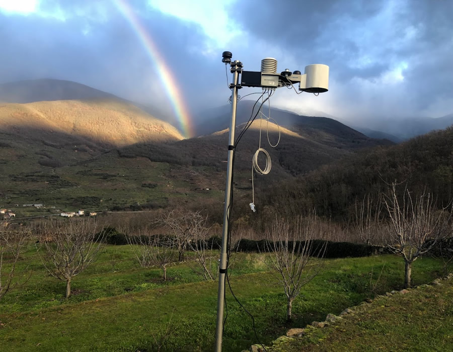
Installation of six FieldClimate weather stations in the Jerte Valley (Extremadura) to obtain climate data representative of different altitudes and exposures (shade/sun). The network improves the accuracy of key agronomic calculations—water requirements, degree days, or chill hours—supporting decision-making by technicians and cherry cooperatives.
Farm challenges
- Lack of representative climate data due to the high altitudinal variability of the valley.
- The REDAREX public station does not reflect actual conditions in shaded and sunny areas.
- Need for accurate information to adjust irrigation and cherry tree management.
Assistance / Boost program
Proyecto REFEX (2023). Acción 2 (Regadíos de montaña).
Innovative features of the initiative / solution
- Distributed network of stations covering different altitudes and orientations.
- High spatial resolution climate data for precision agriculture.
- FieldClimate platform enabling download, visualisation and analysis.
- Improved representativeness compared to the existing public network.
Results obtanied
- Continuous monitoring in six representative areas of the valley.
- More accurate calculation of water requirements, degree days and chill hours.
- Data used by cooperative technicians to optimise cherry tree management.
- Centralised data maintenance and management through the ACVJ.
Lessons learned
- Local stations effectively complement public networks when they do not represent the variability of the territory.
- Technicians quickly adopt the tool when the data is practical and useful for decision-making.
- The combination of stations and cloud platform improves irrigation efficiency and agronomic planning.

